GeoQ Talking Points
Participating and Partnering on the WWW:
- White House Fellows, FEMA, Geo Huntsville, Civil Air Patrol, NPLI, universities, industry (Fulcrum, Mapillary), private citizens, and others.
Implemented Ideas: To generate efficiencies and innovation in tradecraft, tools, and techniques.
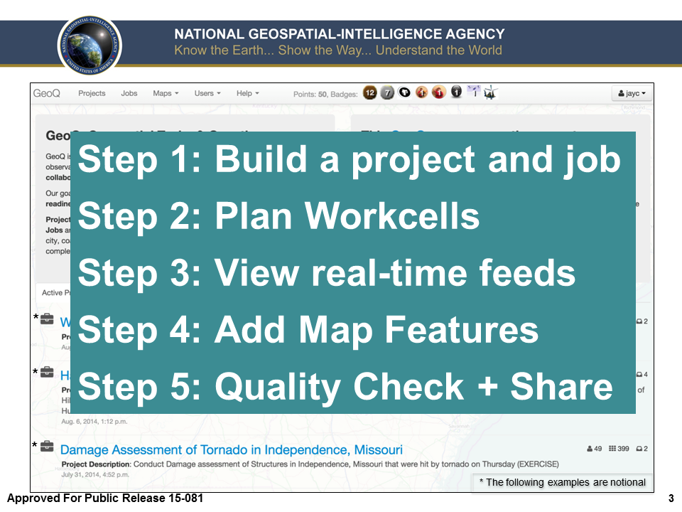
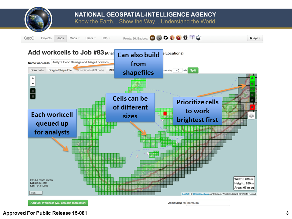
- Common Work Flow (Local, State, Tribal, Federal, IC, DoD, Foreign Partners) - Projects, Jobs and Work cells - unassigned, assigned, in work, awaiting review, completed
- Crowd Sourcing: tailor your own crowd
- Area vs. Image: eliminate imagery overlap (think outside the frame)
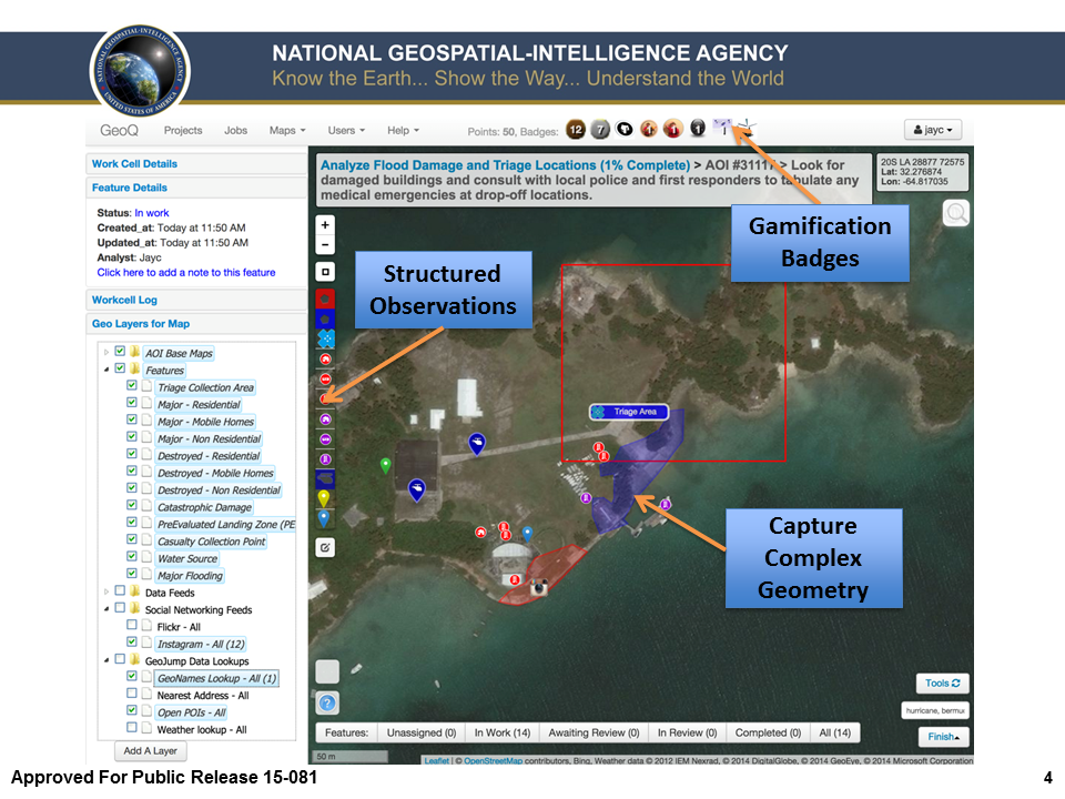
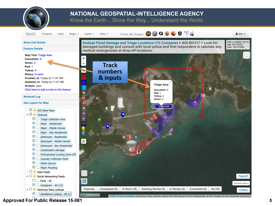
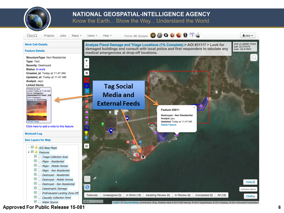
- Common and Structured Observations
- Expose dynamic content in real-time to GeoQ analysts, COPs*, and products
- Integrated QA/QC
- Rapidly integrate traditional and nontraditional/evolving data sources and services (data tsunami)
- Built for centralized or federated data discovery and dissemination
- Easy and intuitive*
- Built for the cloud
- Open source, open APIs and open data standards
- No licensing (HTML5) web-browser-based (desktop, laptop, mobile)
- Automated deconfliction of damage classes (topology)
Transformation: Unclassified Agility & Rapid Prototyping "Concept Car" to drive changes in traditional engineering and acquisition.
- We can validate ideas in days/weeks. (concept car)
- Following the TechFAR, 2012 Digital Government Strategy, and U.S. Digital Services Playbook
- Recycling taxpayer-funded code
- Providing industry real-time insight into our needs (show them not just tell them)
Business Analytics: Enabling real-time, continuous and self-service access to data.
- Timeline
- Project, job and work cell status*
- Dynamic and static reporting* of resources and response
Gamification: Engage the work force and incentivize quality
- Promote quality and quantify tradecraft with points and badges
- Supports standardized web training (EdX)
Feedback: Non-biased testing and evaluation
Change the Geoint Collaboration Model: (fishing poles)
- Teaching others to take the lead and manage events (federation of workload)
- Collaborate and coordinate with others in real-time
- Transcend legal and policy hurdles
Consequence:
- Moore, Oklahoma (Helicopter news footage, Real-time, East, West, Home collaboration, Assessment was >90% complete and accurate before first traditional image, clean topology, gamification)
- Colorado Floods
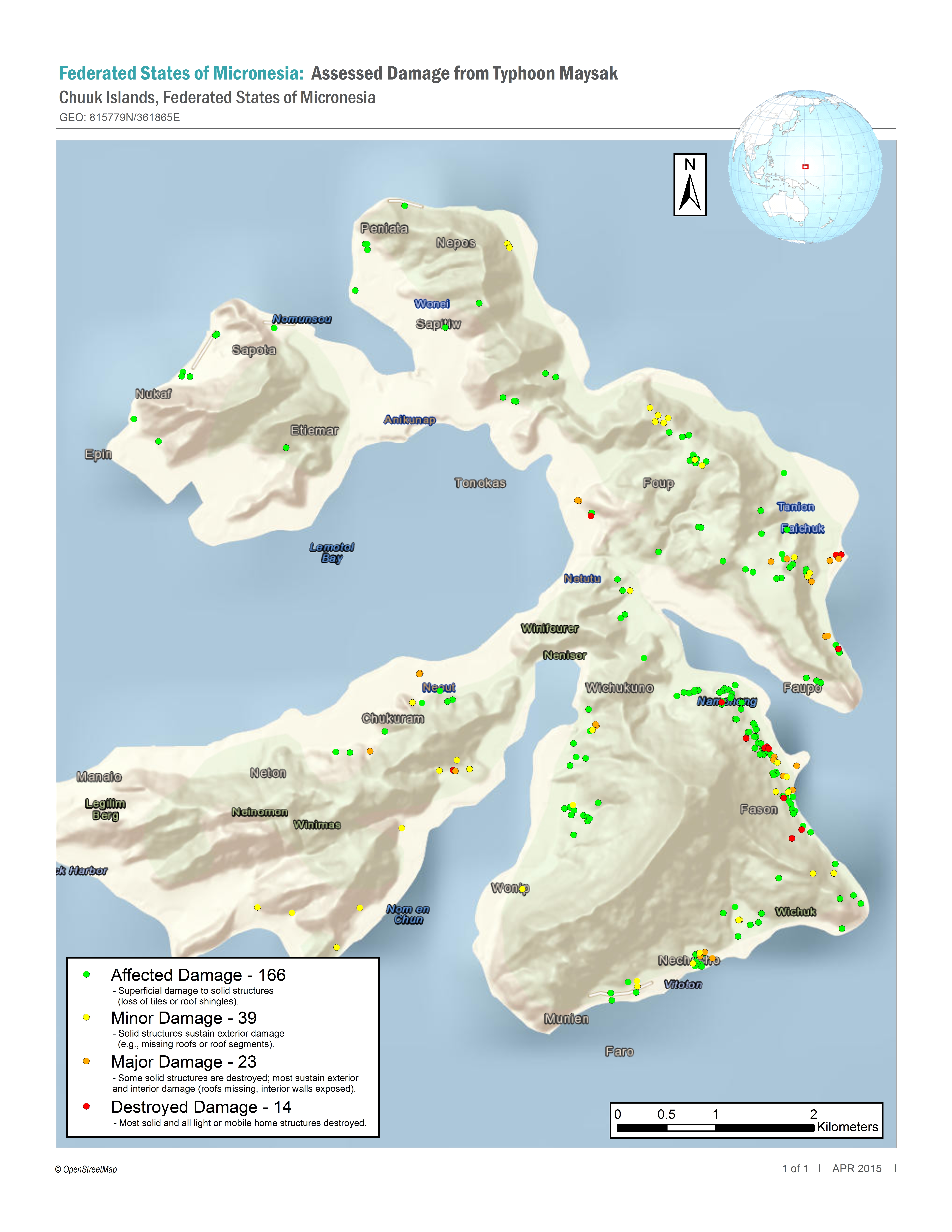
- Typhoon Maysak
- Civil Air Patrol Exercises
- Nepal Earthquake*
- Data Source for Nepal
- Saipan - Typhoon Soudelor (Aug. 2015)
The Way Forward:
- Integration with open source tools and crowds
- Join us on Github
- Pull our code and use as you wish
- Further discussions on workflow and lessons learned
What's Next: Temporal Analysis, Geo?, GeoSwarm, GeoGig and Open Source Stack, GitHub Auction, Harvester ...
Our Strategic Guidance: (If you don't know where you are going any path will get you there.)
-
- User focused and makes their job easier, faster, more accurate
-
- Rewards sharing and promotes tradecraft
-
- Enables work flow
-
- Web browser based as a service
-
- Promotes agility/federated access
-
- Integrated on all domains and transportable
-
- Open/common standards
-
- Open source
-
- Handheld compatible
-
- WWW accessible
-
- Supports disconnected operations
-
- OWF compatible
-
- Centralizes discovery
-
- Built for the cloud
-
- Follows a proven business model