Map of 'bikeable' trips following likely routes based on infrastructure preferences model, using 2011 Transportation for Tomorrow Survey origin/destination pairs and OpenStreetMap (extracted March 5, 2017). 'Bikeable' trips are defined as 1-5 km with no passengers, as used by the Toronto Centre for Active Transportation (TCAT).
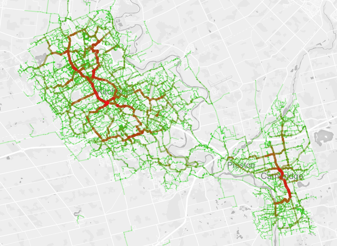
greatest cycling demandleast cycling demand
> python likely_routes.py --osm data/waterloo-17-03-05.pbf --zones data/tts.geojson --zoneid GTA06 --od data/bikeable_wr.txt -n 10000 --output bikeable.geojson
For now, the analyzer considers a single 'shortest' path for each origin/destination pair. (Future work may consider a broader array of likely route alternatives.) Path lengths are weighted roughly by how desireable the underlying infrastructure is for cycling on:
- regular street 1.0
- quiet street 0.85
- busy street 1.7
- bike path 0.33
- unpaved path 0.67
- sidewalk 4.0
- sharrows 0.7
- conventional bike lane 0.5
- protected bike lane 0.4
Weights are cumulative, e.g. a bike lane on a busy street would give 0.5*1.7 = 0.85. Weights are loosely based on the route preference models of Hood et al. and Transport for London.
- Transportation for Tomorrow Survey: Data Management Group
- Open Street Map
- TCAT, Cycling behaviour and potential in the Greater Toronto and Hamilton Area
- Hood et al., A GPS-based bicycle route choice model for San Francisco, California
- Transport for London, Cycle route choice