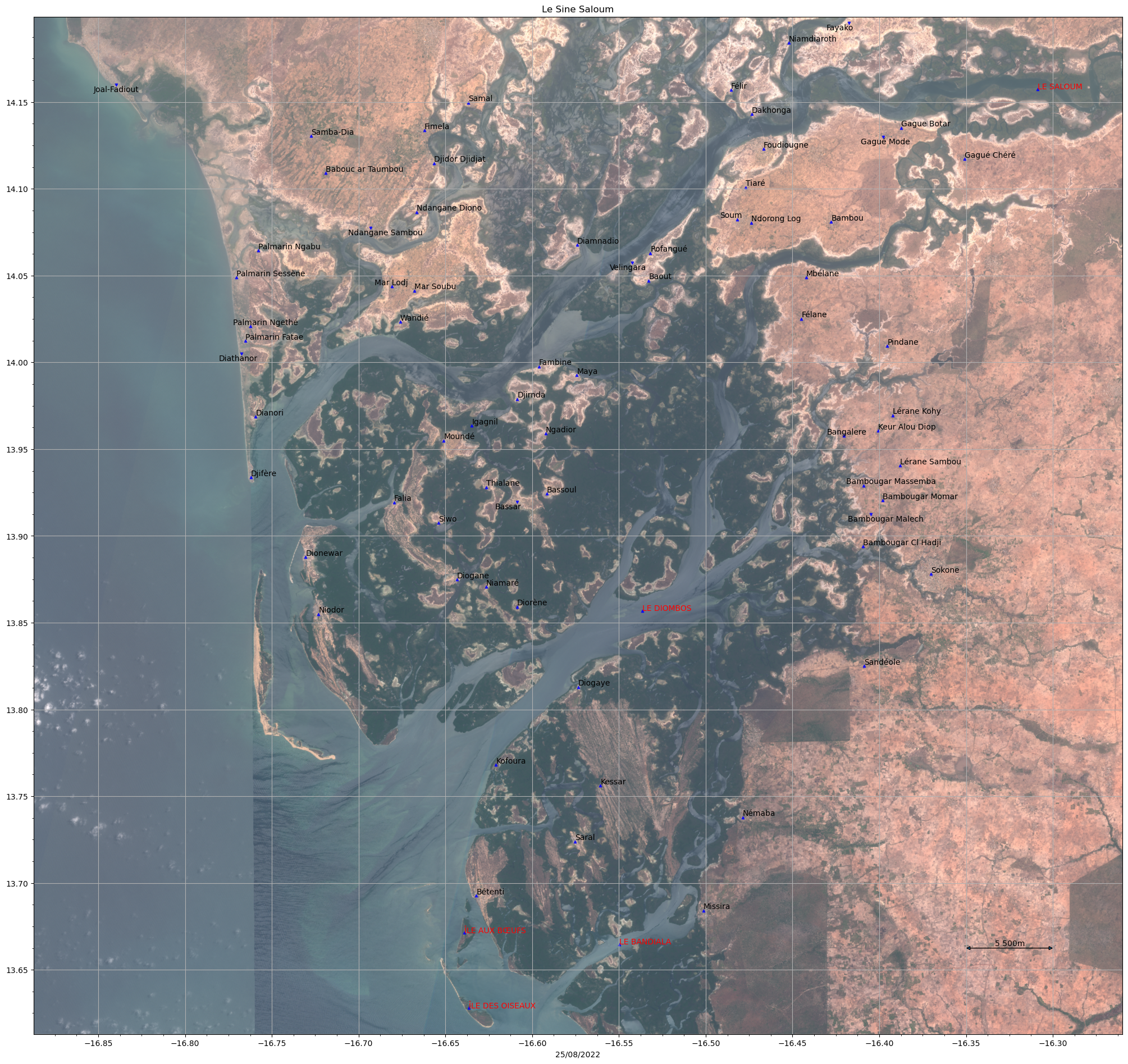
This project provides a modular Python pipeline to:
- Download satellite imagery from the SentinelHub API.
- Convert Google Earth KML files into CSV format containing names and coordinates.
- Plot the extracted points onto the satellite imagery with custom annotations.
- Download high-resolution satellite maps from SentinelHub with minimal cloud coverage.
- Convert KML files into CSV format (compatible with WGS84 coordinates).
- Plot points on top of satellite imagery with customizable labels, corrections, and styling.
- Configurable via a central configuration file (
config.py).
satellite-map/
│
├── satellite_map/                # Core package
│   ├── __init__.py
│   ├── config.py                  # Global variables & configuration
│   ├── downloader.py              # SentinelHubDownload class
│   ├── plotter.py                 # PlotDATA class
│   ├── utils.py                   # Helpers (plot_image, kml_to_csv, etc.)
│   └── pipeline.py                # Orchestrator
│
├── scripts/                       # CLI entry points
│   ├── download_data.py
│   ├── plot_data.py
│   └── full_pipeline.py
|
├── data/
│   └── SineSaloum.kml
│
├── README.md
├── requirements.txt
└── pyproject.toml
- Clone the repository:
git clone https://github.com/yan-sln/Sine-Saloum-Map.git
cd Sine-Saloum-Map- Create a virtual environment and install dependencies:
python -m venv venv
source venv/bin/activate  # On Linux / MacOS
venv\Scripts\activate     # On Windows

pip install -r requirements.txtBefore running the pipeline, you must configure your SentinelHub credentials and project settings.
You must edit satellite/config.py directly, file with the following structure:
instance_id: "your_instance_id"
client_id: "your_client_id"
client_secret: "your_client_secret"
bbox: [-16.9, 13.6, -16.3, 14.2]
resolution: 30
start_date: "2019-06-01"
end_date: "2022-07-25"
kml_path: "data/input.kml"
csv_path: null
output_dir: "SentinelDownload"python scripts/full_pipeline.py
python scripts/download_data.py
python scripts/plot_data.pyThis will:
- Download imagery from SentinelHub,
- Convert the KML file to CSV (if needed),
- Plot the points on the satellite map,
- Save the final annotated image into the
SentinelDownloaddirectory.
- Python 3.10+
- sentinelhub-py
- pandas
- matplotlib
All dependencies are listed in requirements.txt.
- Add shapefile support for spatial inputs.
- Validate coordinates against the bounding box.
- Extend plotting options (color maps, layers, interactive visualization).
- Improve error handling and logging.
After running the script, the output will be a map like the following example: